LahnWeinStieg
Short facts
- start: Railway station
- destination: Railway station
- medium
- 10,70 km
- 3 hours 53 minutes
- 463 m
- 264 m
- 97 m
- 100 / 100
- 60 / 100
best season
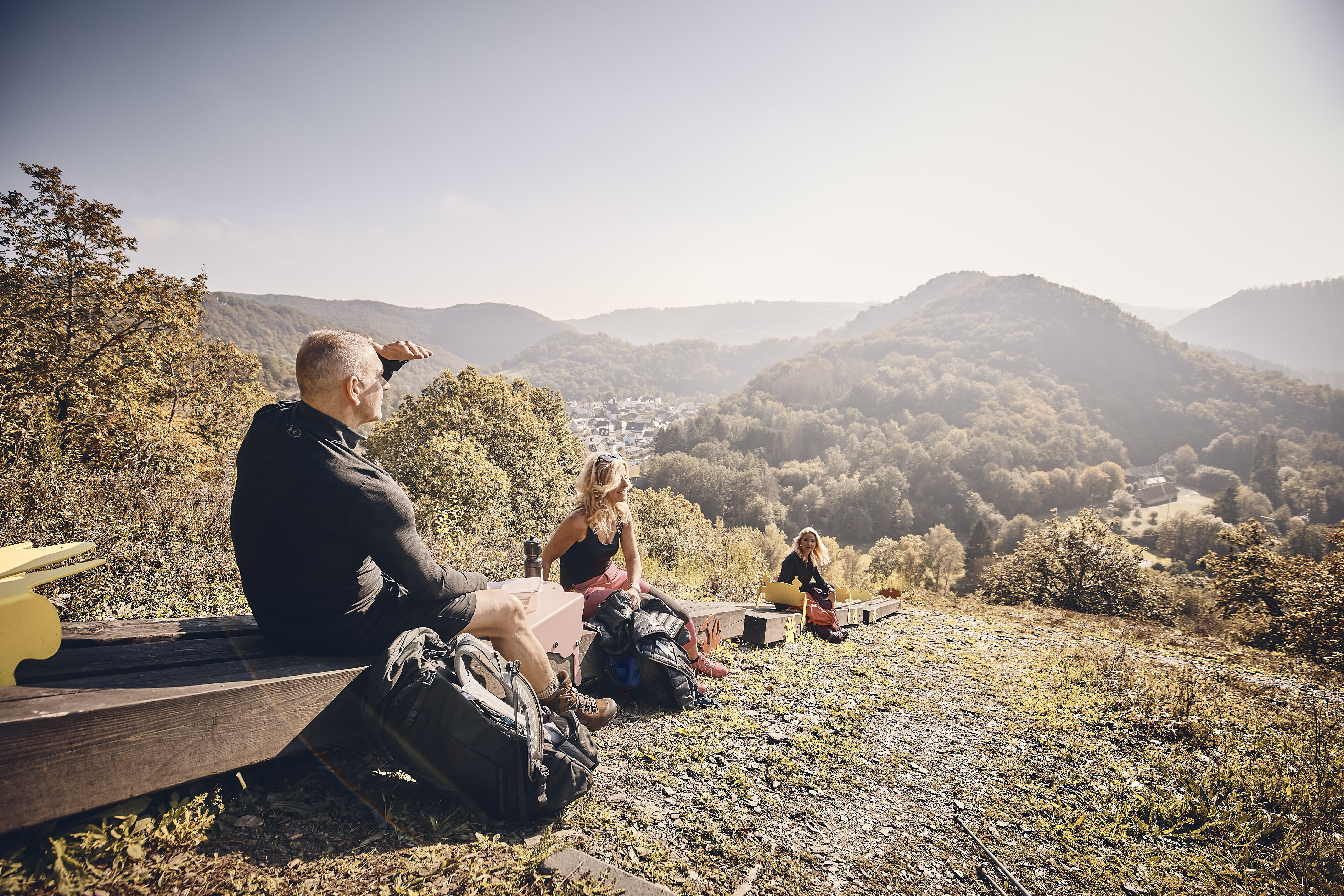
Exciting, sporty, spectacular! Even the most experienced hikers rave about the new LahnWeinSteig.
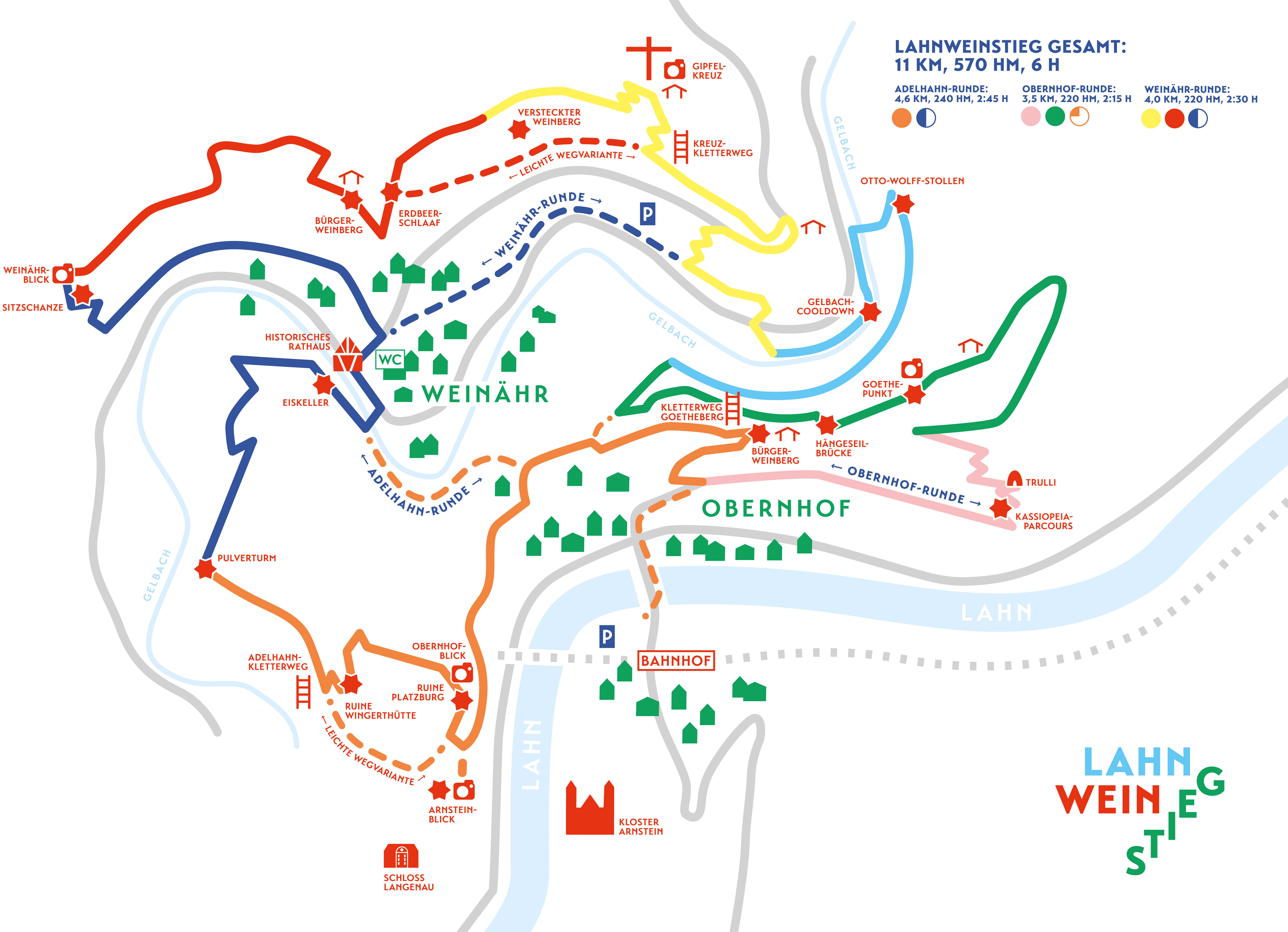
If the 10.7 km circular trail is too strenuous for you, you can also hike the LahnWeinStieg in smaller stages. Starting points of the


General information
informations
- Nature Highlight
- Cultural Interesting
- Stop at an Inn
- Possibility of Accommodation
- Tour with Dog
- Climbing Site
- Premium Trail "Wanderbares Deutschland"
- Good Connection to public Transport
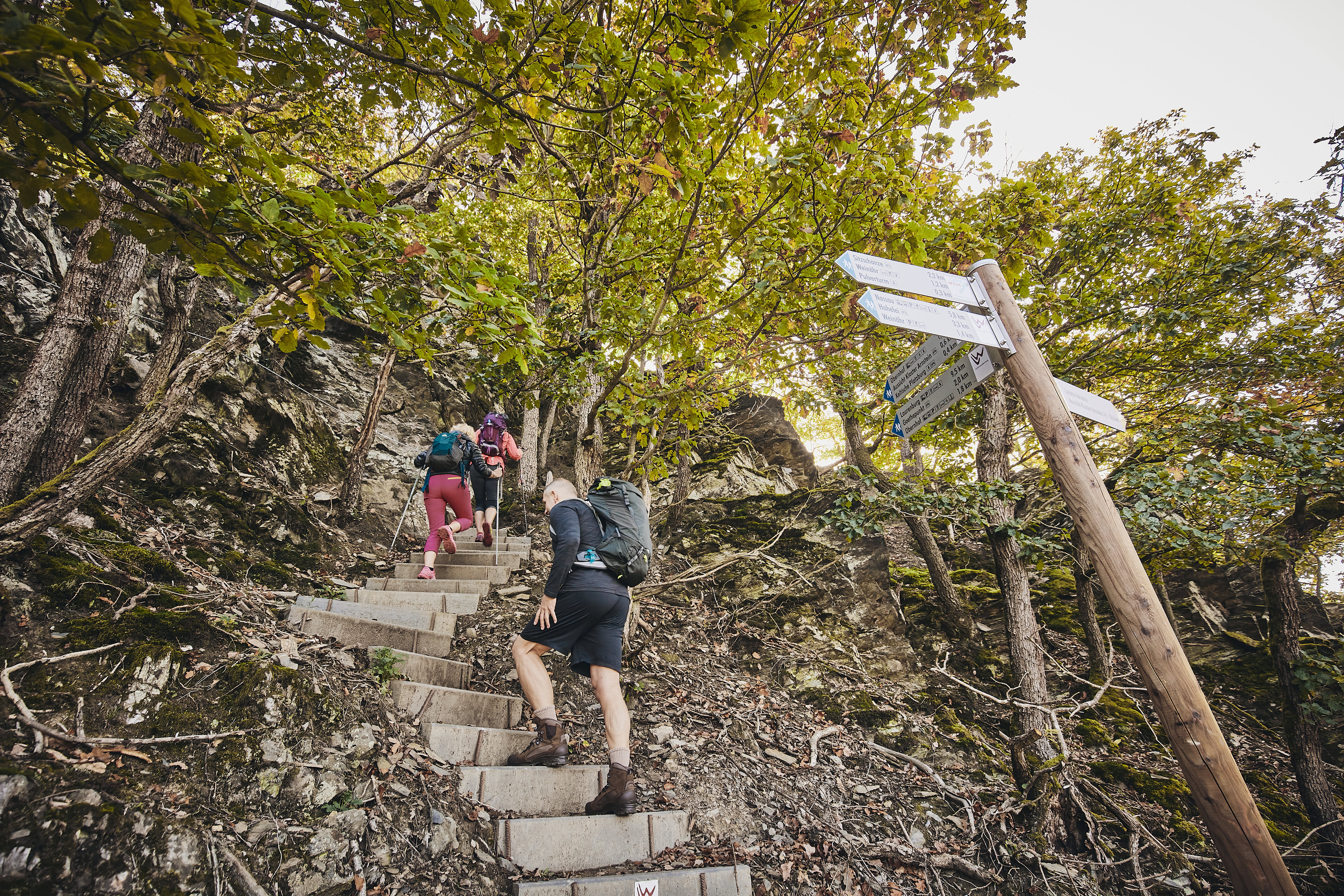
Directions
From Obernhof station or the car park nearby, walk to the Lahnbrücke bridge. In the extension of the bridge, the Lahn wine trail begins in Borngasse. Passing old half-timbered houses, you walk up Borngasse - later Esterweg - to the first vineyard slope in Obernhof.
The mixture of old and new masonry to the left of the path shows that an old vineyard is being rebuilt here. With EU funding, viticulture on the Lahn is being given a future and, "incidentally", the Lahnweinstieg has emerged as a further economic development for rural areas, now for tourism.
The young vineyard is followed by a section with small historic terraces, the Schreiberlay site. The hidden tunnel access in the old walls originally led to a wine storage facility with "natural cooling", a board provides information about this old vineyard.
Shortly after this point, take the right-hand path at the next junction and walk past walls overgrown with brambles to a fallow area in the vineyard. You can see from the remains of slate terrace walls that there used to be vines here.
The Cassiopeia trail leads through this area with the old, "empty" terraces, which is also the first really steep ascent.
Botanists will be delighted with the variety of plants here.Walking up the narrow steps - watch out for blackberry plants in the cracks - you get an initial idea of how arduous the work in the vineyard once was. The answer to why this section of the path is called the Cassiopeia course naturally follows.The stone rattle that you climb past gives you an idea of the work involved in creating a vineyard. The harvest stones now provide an important habitat for small animals.
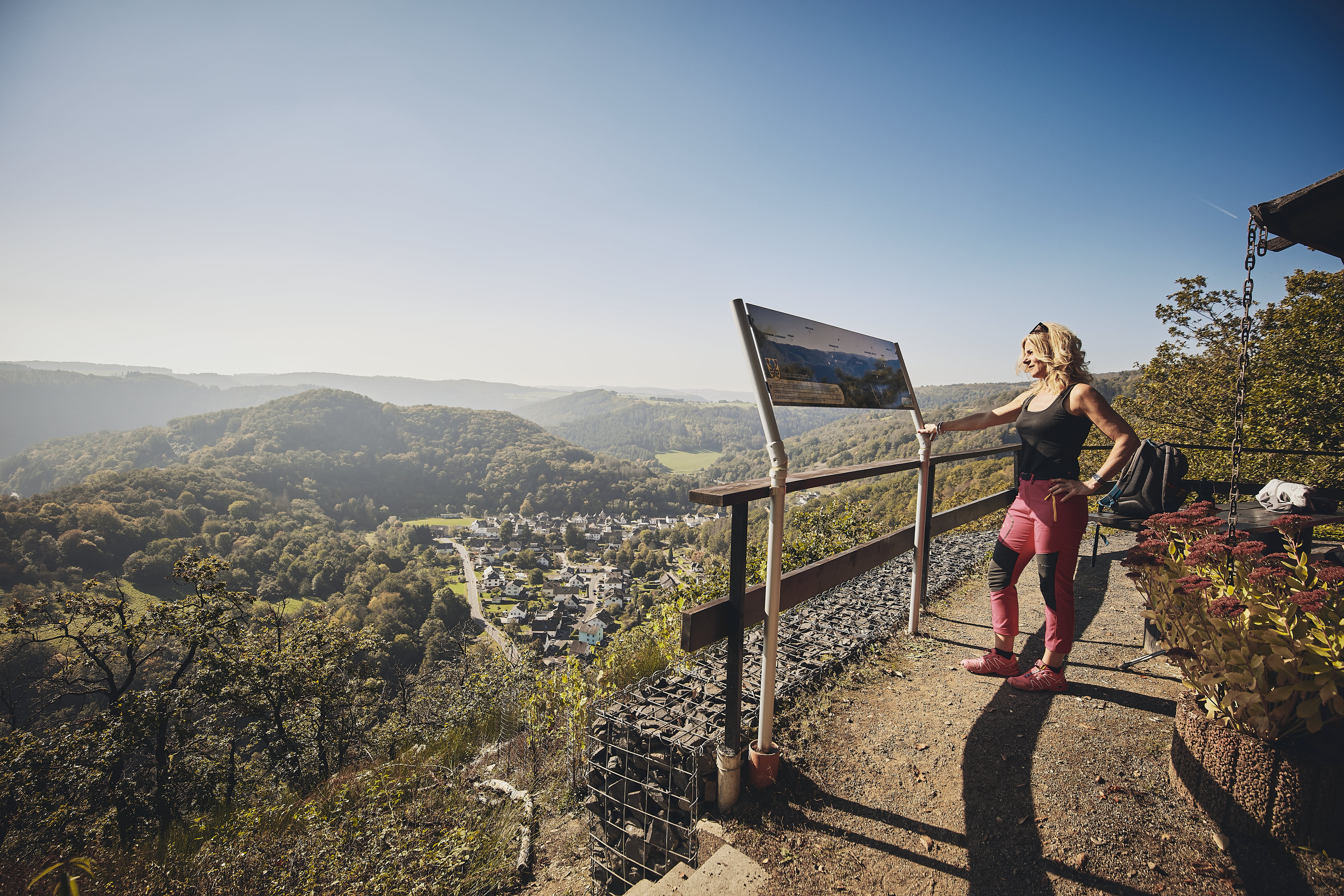
At the end of the Cassiopeia trail, turn left to climb up the next vineyard wall on the right. To catch your breath before the next steep climb, there is an information board about the Goetheberg and the history of viticulture on the Lahn since the Middle Ages.By the way, Goethe really was in Obernhof. In steep serpentines on a narrow path - blackberry alert in the upper section! - then ascends slightly to the left with a panoramic view.
Finally, the Goethepunkt 0.7 km sign announces a highlight of the tour.
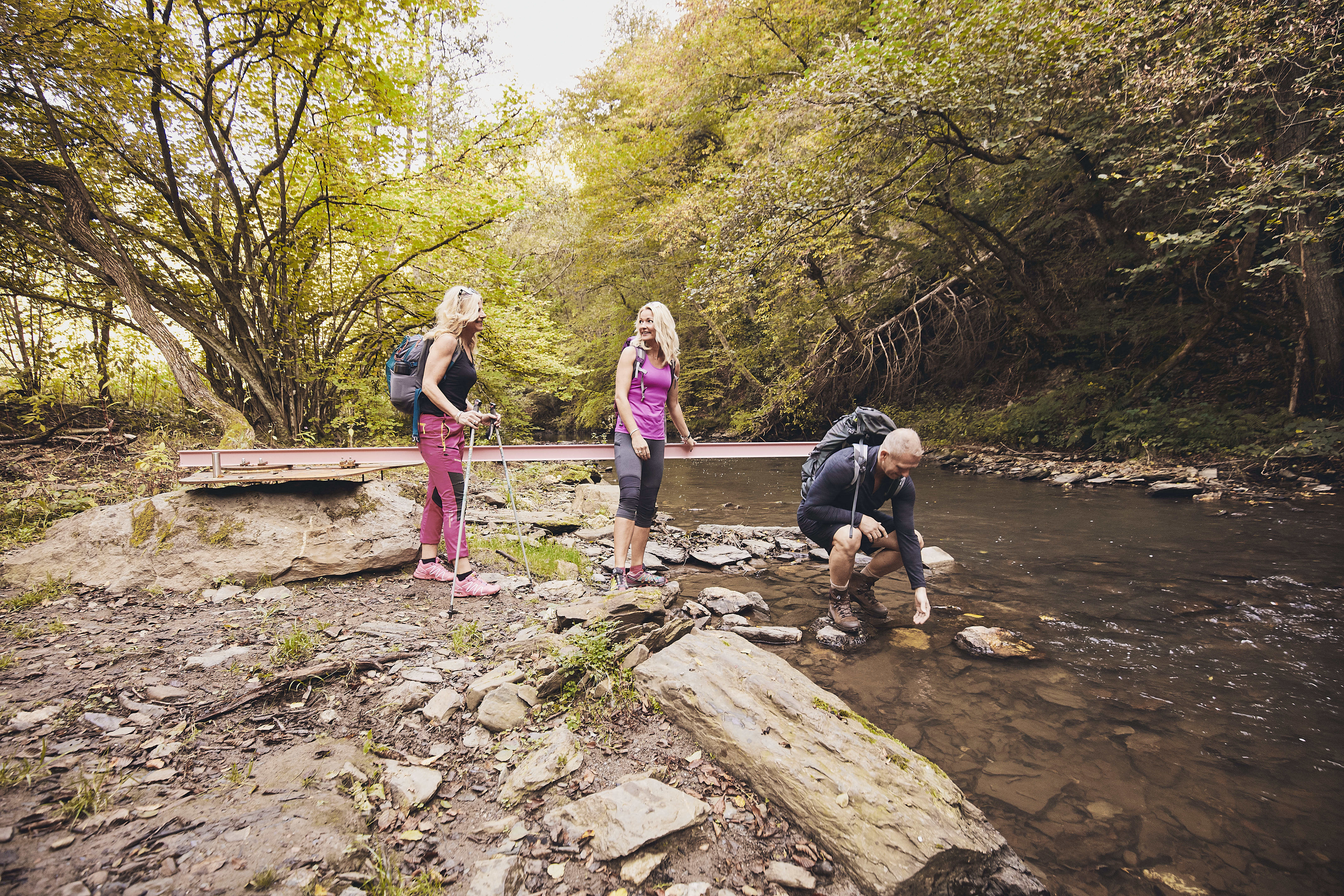
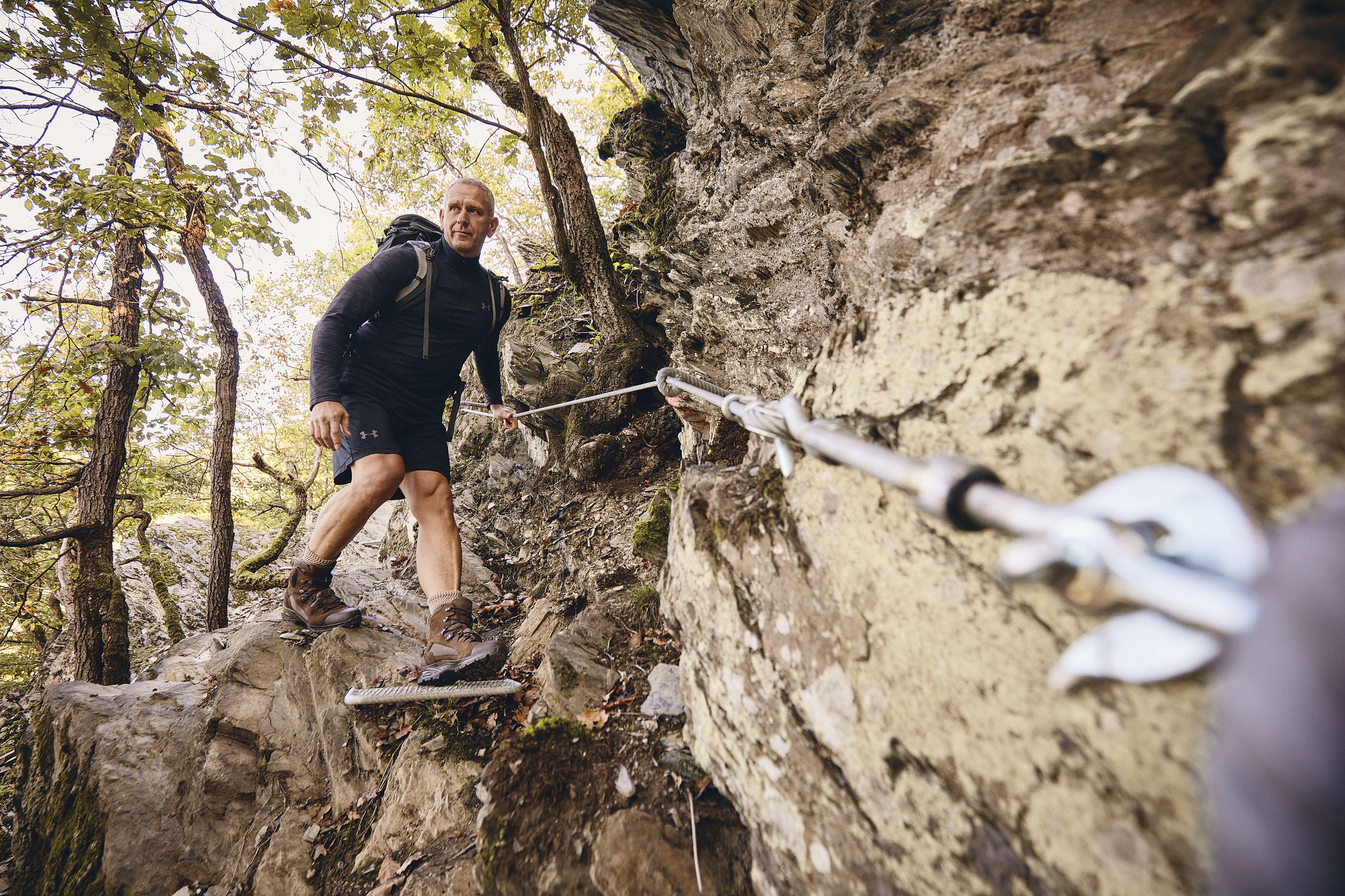
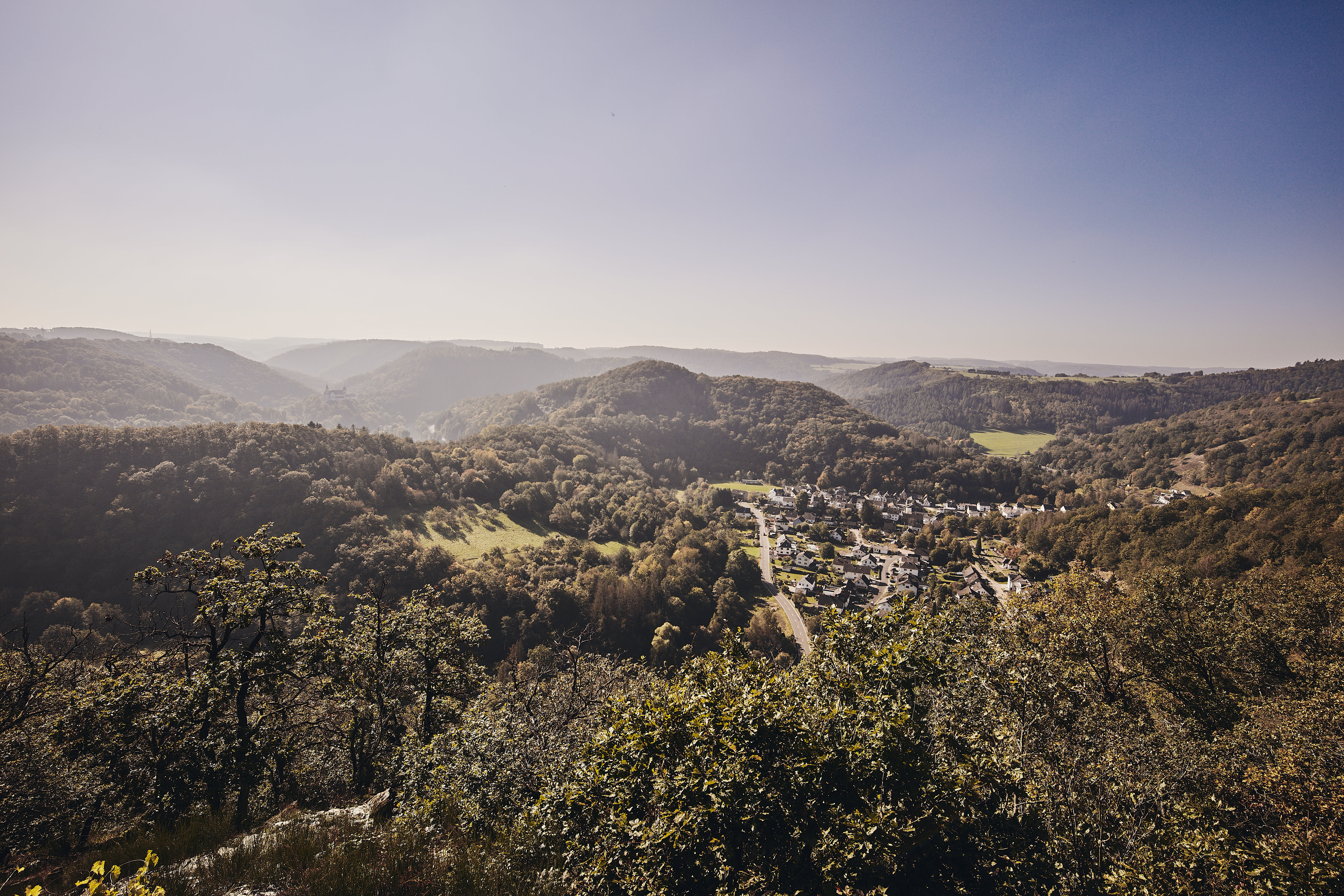
Now you leave the Obernhof vineyard slope and climb up through the forest. At the crest of this path, turn left, then pass a weather hut for a dry picnic and you will see the viewing platform of Goethepunkt on your right.From here there is a panoramic view from Obernhof to Weinähr.Then it gets slightly alpine: the descent from Goethepunkt is secured with handrails and steel cables, which secure the walk over the small rocky sections.In addition to the distant views, there are also views down below!Descend along a narrow path through the forest towards the Gelbachtal valley.At the end of this path, turn right (Otto-Wolff-Stollen 0.9 km) and now walk leisurely through the forest, more or less staying at the same level.The Otto-Wolff-Stollen, a relic of mining in the Gelbachtal valley, is now a habitat for bats; the small hole serves as an entrance and exit for them.From the tunnel, turn right down a path to the Gelbach stream.Cross a narrow bridge to the right bank of the Gelbach and follow the watercourse.Non-native plants (neophytes), Indian balsam and Canadian goldenrod are spreading in the floodplain area and suppressing the native flora.
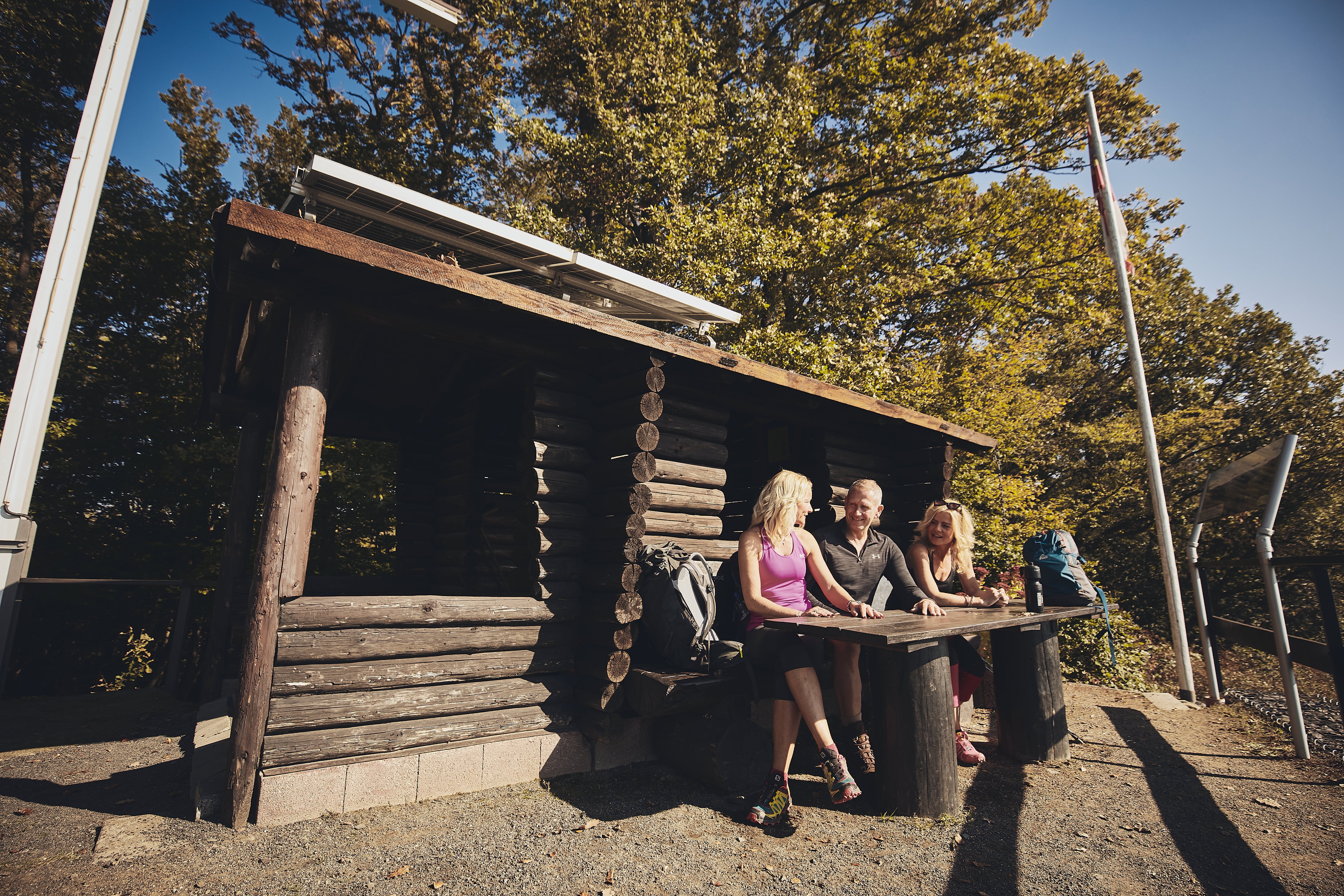
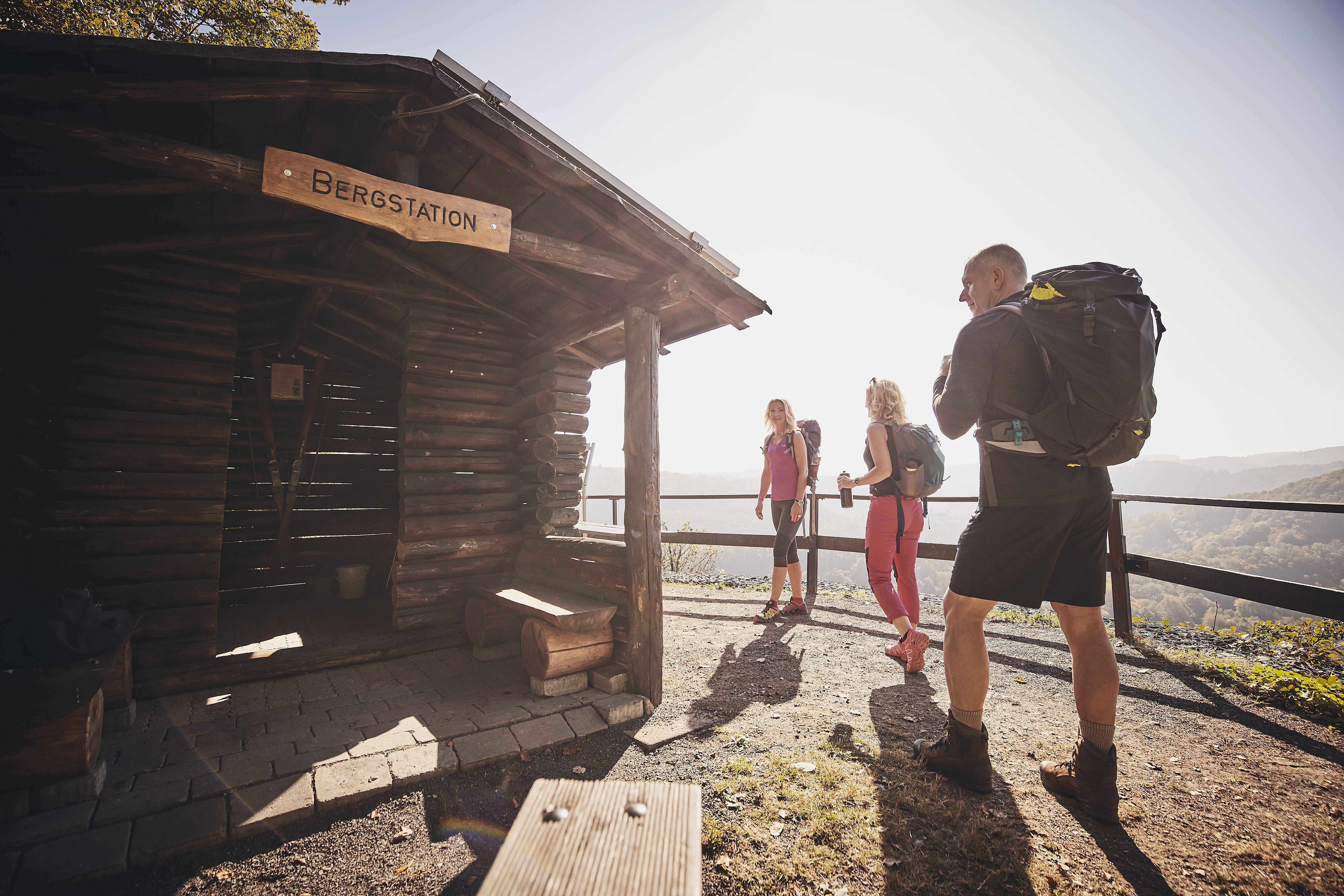
At the end, the path leads to the L 325, which you cross and climb up into the forest immediately after a dry stone wall.In the now dense forest, you will repeatedly come across the remains of terraced walls of a vineyard.At the end of the path, the trail continues slightly downhill to the left until you reach the next overgrown vineyard on the right, through which the trail climbs uphill on hairpin bends.Blackberry alert! Walk parallel to and slightly below the K 5 to the so-called middle station, a log cabin for a rest.
From the middle station, you climb to the next bend in the road, where the Lahnweinstieg trail branches off to the left.Staying at an altitude, you walk towards Weinähr and reach the next "alpine" challenge: the 200 metre long and steepest ascent of the entire tour to the summit cross.You can enjoy the panoramic view over Weinähr and the surrounding countryside from the comfort of a wooden lounger.
The rest of the trail naturally only leads downhill, keeping to the left immediately after the rest area and coming to colourful metal poles in the forest.They show that there were once vines here too and that many wooden stakes were needed to tie up the vines. For this reason, coppicing was practised in the forests of the region, resulting in characteristic tree shapes.Here you can see that hazel bushes provided the stakes.
You follow the path further downhill and come across tree trunks lying next to the path with plastic strawberries screwed onto them. The explanation can be found at the bottom of the unpleasantly steep path - slate rubble makes it slippery.
After gaining new knowledge about the strawberry slag, you walk through the adjoining young vineyard, which is managed by an association of enthusiastic amateur winegrowers as the "Weinähr Citizens' Vineyard".At the next edge of the forest, the trail climbs up a flight of steps and turns left at the end, where the coppice forest and historic vineyard terraces are already familiar to you.
At the end of the path at a tunnel entrance to the Weinähr waterworks, turn right to reach the Giebelhöll seating hill. You should try out the unusual and photogenic seating before descending the open slope and forest edge.At the end of the path, turn left towards the houses of Weinähr.With the church tower in view, walk through the village (Hinterwies street, at the bend through a small alley towards the church tower and turn right onto Bornstraße. Before the picturesque half-timbered houses, turn left briefly (towards Montabaur) and immediately turn right again to walk over a bridge to the right along the Gelbach stream.
At the clearing, climb up to the left into the forest and circle the Bernshahnerkopf more or less at the same height. When the railway tracks come into view on the right, the last "alpine" ascent is soon ahead - actually directly above a railway tunnel entrance. At the Adelhahn climbing trail, you have to put your hands on the ladder and rock again.At the end, turn right at a height to the so-called Platzburg, from which you shouldn't expect anything, but a beautiful view from Arnstein Monastery to the vineyards of Oberndorf, the start of the tour.From the vantage point, descend between the edge of the forest and the gorse and bramble thicket, turn left at the end (for the tireless, there is a short detour to the right to another viewpoint of the monastery) and follow the path towards Obernhof.However, you don't return to the village straight away, but the Lahnweinstieg takes a short detour into the forest.Don't be surprised to find yourself above the rooftops of Weinähr again!After the short detour into the forest, you emerge above the Obernhof vineyards.On the Obern Neuweg, you walk across the vineyard, learn something about the historic vineyard garden, climb the new stairs, which are wide for a vineyard, and then after a few steps turn right down to Obernhof.(Text: Dr Gabriele M. Knoll)
Safety Guidelines
Sturdy footwear is essential for enjoying this hiking trail, as there are "semi-alpine" passages over small rocky sections, as well as various ladders as climbing aids. You need to be sure-footed and have a head for heights! Long and deep views are part of the offer on this trail. The relevant sections of the trail are only suitable for older children who are already able to walk off-road. Dogs won't be able to manage the steepest sections with the steps and ladders. However, there is always an easy version of the trail on the more challenging sections, which is suitable for children and dogs - as well as those who don't want to be so sporty.
Tip
Even though the 11-kilometre walk takes just under four hours, you should leave enough time for the hiking pleasure, the many information points along the way and the spectacular views. Make a day trip out of it!
Parking
At Obernhof railway station
Public transit
By train to Obernhof
Additional Information
Detailed information at lahnweinstieg.de